
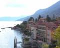
Le più ricercate sul Lago Maggiore


A Besozzo torna “Storie in tasca”, il Festival Internazionale di narrazione
Venerdì 13, sabato 14 e domenica 15 ottobre sono le date che dovete segnare se avete voglia di quel qualcosa di diverso … un divertimento fatto di sostanza, o meglio, se avete voglia di spettacoli di teatro di narrazione! Torna infatti STORIE IN TASCA, alla Sala Mostre del Comune di [...]
C’erano una volta… i Castelli di Cannero. E ci sono tuttora
Tre gli isolotti rocciosi di fronte Cannero Riviera. Due quelli che ospitano le fortezze costruite nel XII secolo circa. Si tratta dei Castelli di Cannero, simbolo per eccellenza del Lago Maggiore. Spesso, avvolti dalla fitta nebbia, i Castelli paiono essere sospesi tra cielo e acqua. Gli isolotti dove le fortezze [...]
Settembre, tempo di vendemmia. Al via la sagra dell’uva a Borgomanero
Profumo di mosto e tempo di festa a Borgomanero. Nel comune della provincia di Novara, che si adagia su una conca pianeggiante, alle pendici dei primi rilievi collinari-montuosi delle prealpi, poco distante dal Lago d’Orta, stanno per iniziare dieci giorni di convivialità, spettacoli, sport ed enogastronomia. Un “assaggio” (metaforico) della [...]
Corsa Vintage sul Lago Maggiore
120 anni dopo. 10 auto del periodo precedente la Prima Guerra Mondiale. Torna la Arona-Stresa sul Lago Maggiore, dopo aver corso nel 1897. E torna con dieci auto storiche, costruite prima del 1915, immatricolate entro il 1939, gioielli di assoluta rarità. Accanto alle dieci perle preziose, ulteriori veicoli che hanno [...]
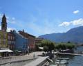
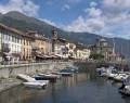
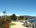
Il Lago Maggiore
Oggi è sempre più facile scoprire il Lago Maggiore ed i suoi paesaggi assolati per godere della diversità del territorio: il lago contrapposto alle montagne, la città ai graziosi villaggi. Le sponde del Lago Maggiore, grazie al loro fascino, rappresentano da sempre una meta ambita da poeti, scrittori e personaggi di tutti i tempi. La sua felice posizione, la ricchezza di storia e il clima mite sia d’estate che d’inverno, hanno fatto nascere lungo le sponde diversi centri residenziali, frequentati da italiani e stranieri. Inoltre il territorio offre magnifici golf resort posizionati ai primi posti della classifica dei più prestigiosi campi da golf italiani. Il golf club di Castelconturbia e il Bonora di Bogogno sono punto di ritrovo imprescindibile per tutti i golfisti più esigenti e appassionati.